Michigan County Adjacencies
Nov 28, 2020 · 227 words · 2 minutes read
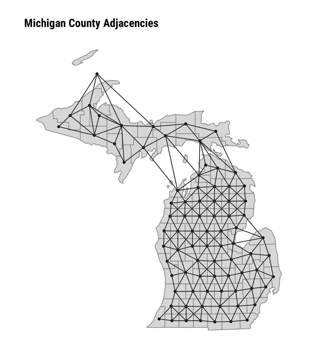
Geospatial data analysis exploits the first law of geography that units close together are more related than those that are distant. Spatial models for areal data, such as intrinsic conditional auto-regressive (ICAR) models, typically characterizes the relationship between units (i.e. near or distant) in terms of adjacency. Typically adjacency, or neighbor relations, can be determined from the areal data itself by assigning relations to units with common borders and/or vertices.
However Michigan is divided into an upper and lower peninsula, separated by the Straits of Mackinac. This can present a problem for those interested in geospatial analyses because the landmass of the peninsulas do not touch and thus leads to an issue with the spatial weights matrix.
Fortunately the National Bureau of Economic Research (NBER) hosts U.S County Adjacency files from the U.S. Census Bureau. The adjacency files identify which counties should be treated as neighbors. These differ from neighbor designations determined by typical spatial methods (e.g. common edge) by assigning neighbor relationships to counties that may be proximal but do not touch. For example the geospatial polygons for Mackinac County, MI and Emmet County, MI don’t touch but they are connected by the Mackinac Bridge and thus are considered by the U.S. Census Bureau to be neighbors.
The map below shows the connectivity of each Michigan county with its neighbors, using the U.S. Census adjacency designations.